


Core Platform
More Than a Map. More Than a Dashboard.
TaskMapper is the operational layer that connects field reality with project controls, quality, documentation, and asset history.
One Geospatial Digital Twin
Instead of switching between disconnected tools, teams work from one asset-linked platform that keeps everyone aligned.
From Site Teams to Executives
Built for site teams, EPCs, owners, and O&M teams - everyone works from the same live system of record.
Field Reality Meets Project Controls
Connect what is happening on the ground directly to schedules, quality workflows, and documentation in real time.
Triple Digital Twin
Built on the Triple Digital Twin.
At the core of TaskMapper is a relational system model that brings together three layers of project intelligence
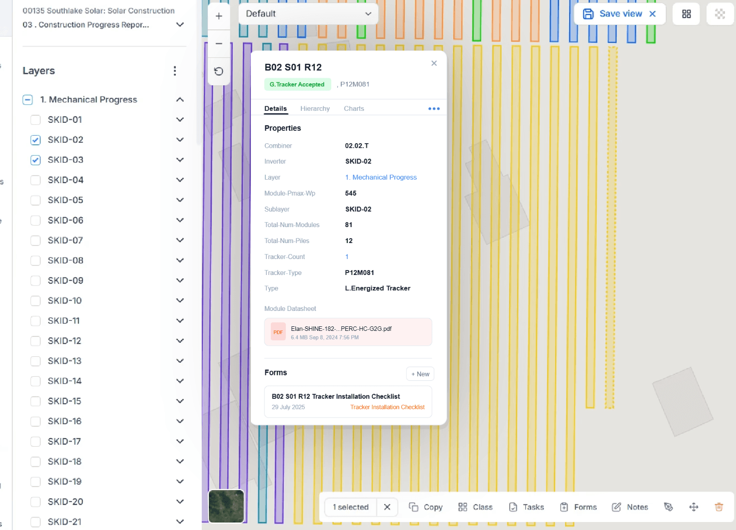
Equipment Twin
A connected asset model from module to substation, with serial numbers, datasheets, warranties, IV curves, test results, and maintenance history.
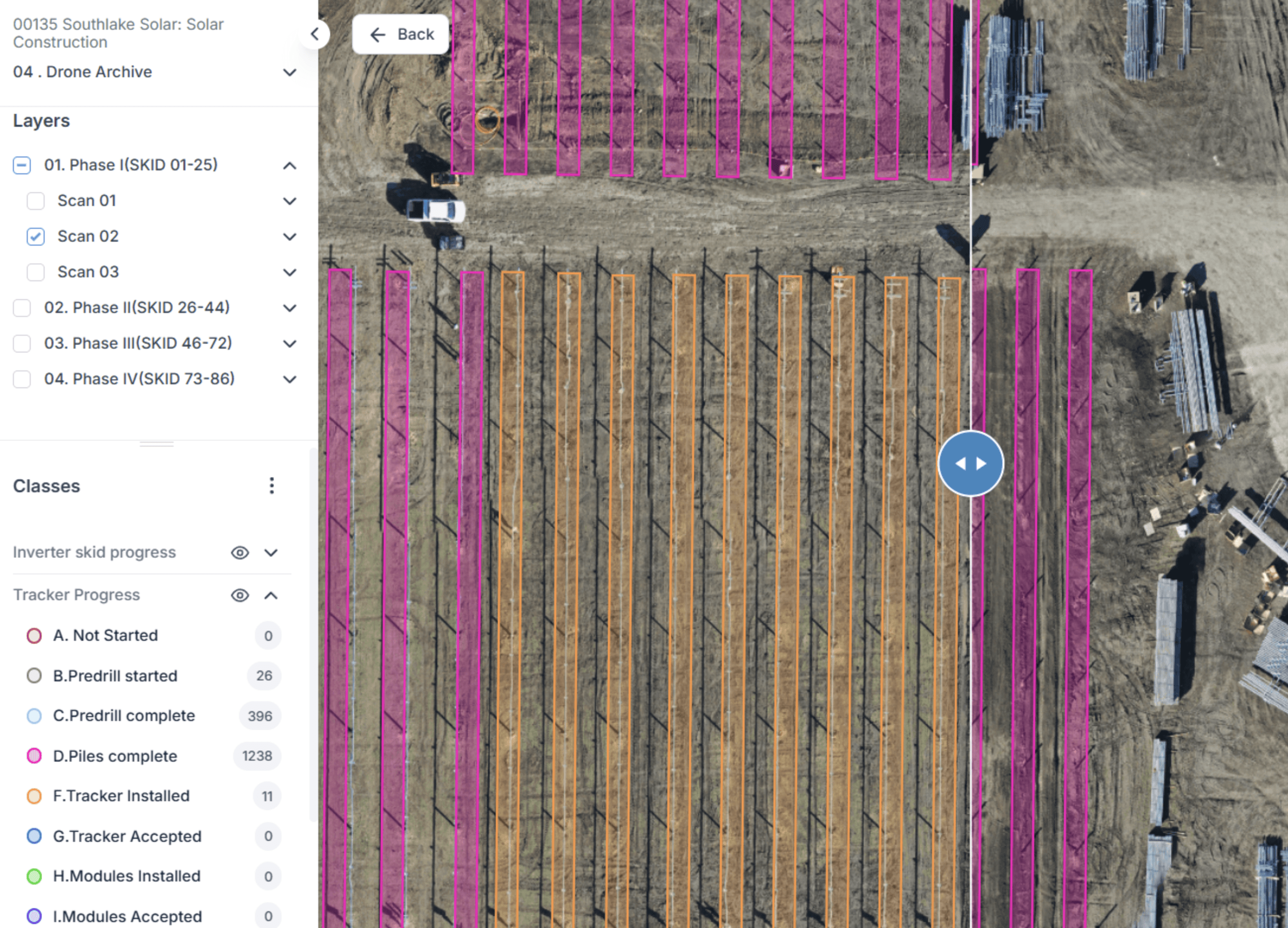
Map Twin
A geospatial layer that unifies GIS, CAD, orthomosaics, terrain, surveys, and field context into a single visual environment.
Process Twin
A workflow layer that connects schedules, inspections, approvals, punch lists, quality events, and construction activities to real assets and locations.

Together, these layers make TaskMapper a true digital twin - not just a visualization tool, but a connected operational system for the full asset lifecycle.
Lifecycle Coverage
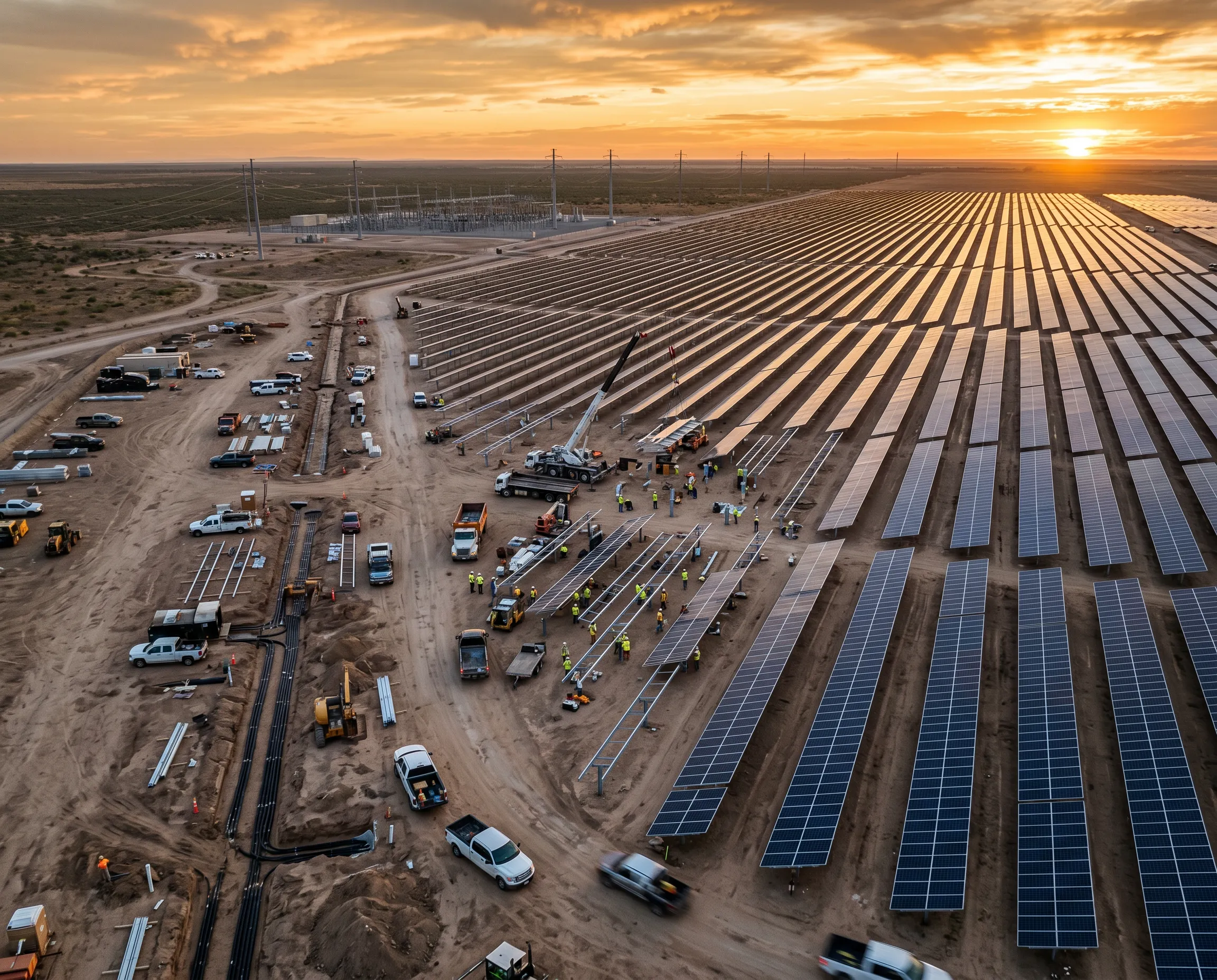
From Groundbreaking To Grid Operations
TaskMapper provides a continuous digital backbone across every phase of a solar asset’s life. Teams can use one connected platform for pre-construction planning, construction execution, commissioning, handover, operations, maintenance, and end-of-life decisions. That continuity reduces data loss between teams, shortens handovers, improves traceability, and creates a stronger operational foundation long after COD.


Our Features
Everything your team needs - in one place
Your project data flows seamlessly from planning through construction to long-term operations — nothing gets lost between phases.
Maps
Tasks
Forms & Workflows
Files & DMS
BI Dashboards
Project Management
Inventory
Mobile App
System Model
Drone Analytics
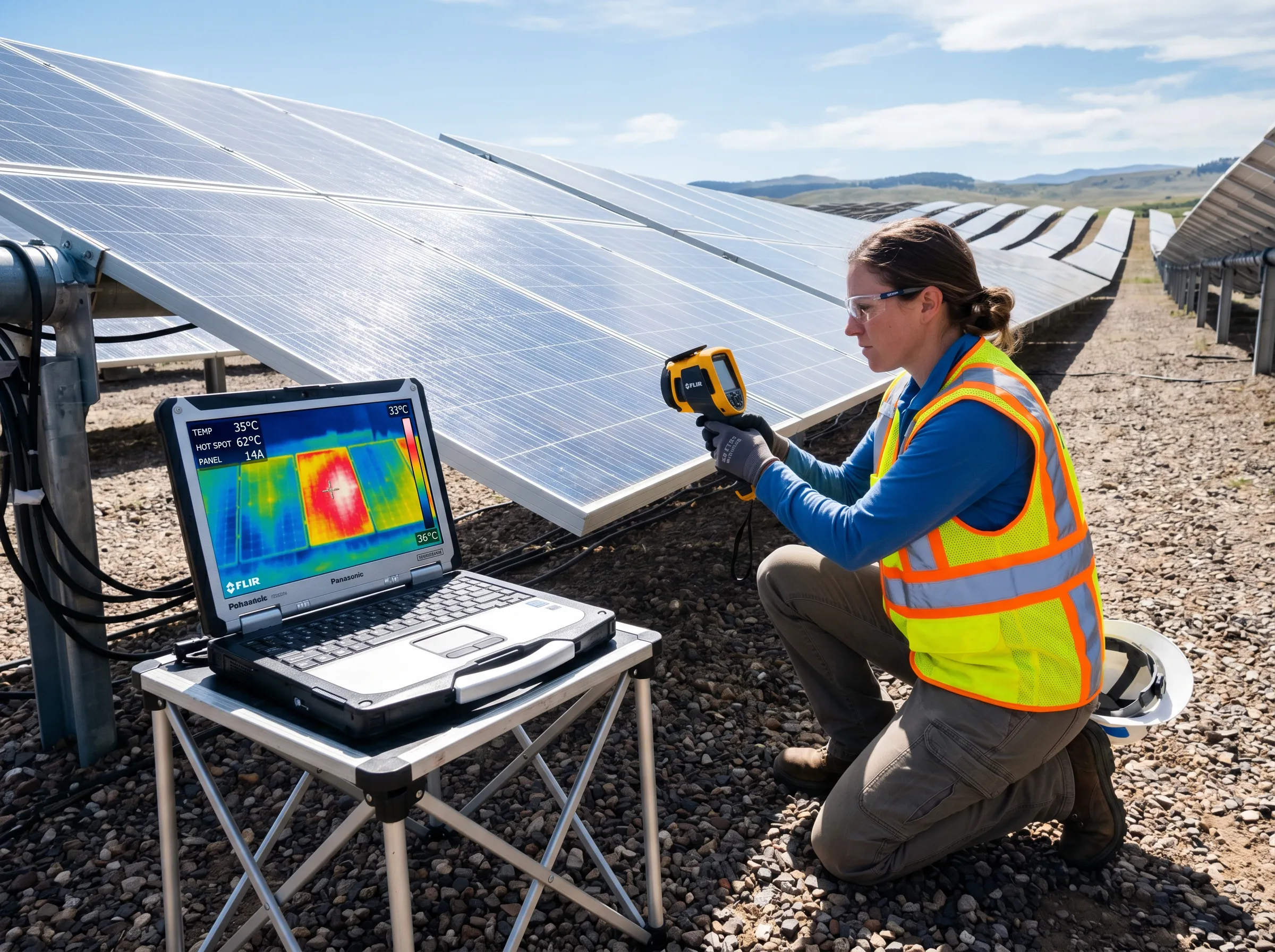
Therm
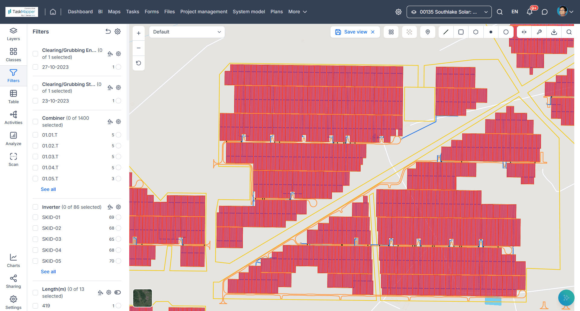
Your entire project site on an interactive map. Layer drone imagery, satellite photos, and CAD designs. Track progress block by block — visually.
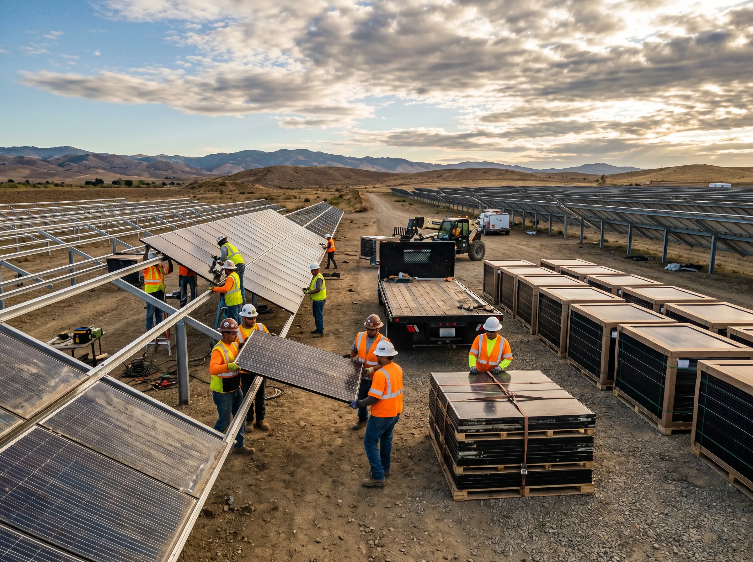
Field & Enterprise
Built for the Field. Trusted by the Enterprise.
TaskMapper combines mobile-first usability with enterprise-grade control. Field teams can capture progress, photos, forms, punch lists, and inspection data directly on the map - even in low-connectivity environments. At the same time, managers and executives get role-based dashboards, live progress views, root-cause analysis, and audit-ready records across projects and portfolios.
Offline-capable mobile workflows
Geo-tagged forms, notes, & evidence
Real-time sync to dashboards and reports
Role-based visibility for site, PMO, leadership, & O&M

Decision Intelligence
Live Progress Tracking
Monitor S-curves, milestones, and critical path activities across every project in real time - no manual updates required.
Drill Into Root Cause
Move from a high-level portfolio trend into the specific contractor, asset, workfront, or issue driving it in just a few clicks.
Earlier Risk Intervention
Spot risk signals before they become delays. TaskMapper gives teams the context to act early and protect project margins.
AI Copilot
Ask the Project
NaaviX, TaskMapper’s built-in AI copilot, helps teams interact with project data in natural language. Instead of navigating multiple dashboards, users can ask questions like:
"Show me the current workrate of piling in Block 1."
"Give me a summary of lagging electrical activities."
"Which strings have repeated thermal anomalies?"
"Show open torque issues by contractor"

Proven On Utility-Scale Solar Programs
Sites Digitized Across 20+ Countries
Built To Support Complex, Multi-Stakeholder Solar Delivery At Scale
Frequently Asked Questions
Is TaskMapper a GIS tool or a Project Management tool?
How many users can I have on TaskMapper?
Can I view historical data of the site?