


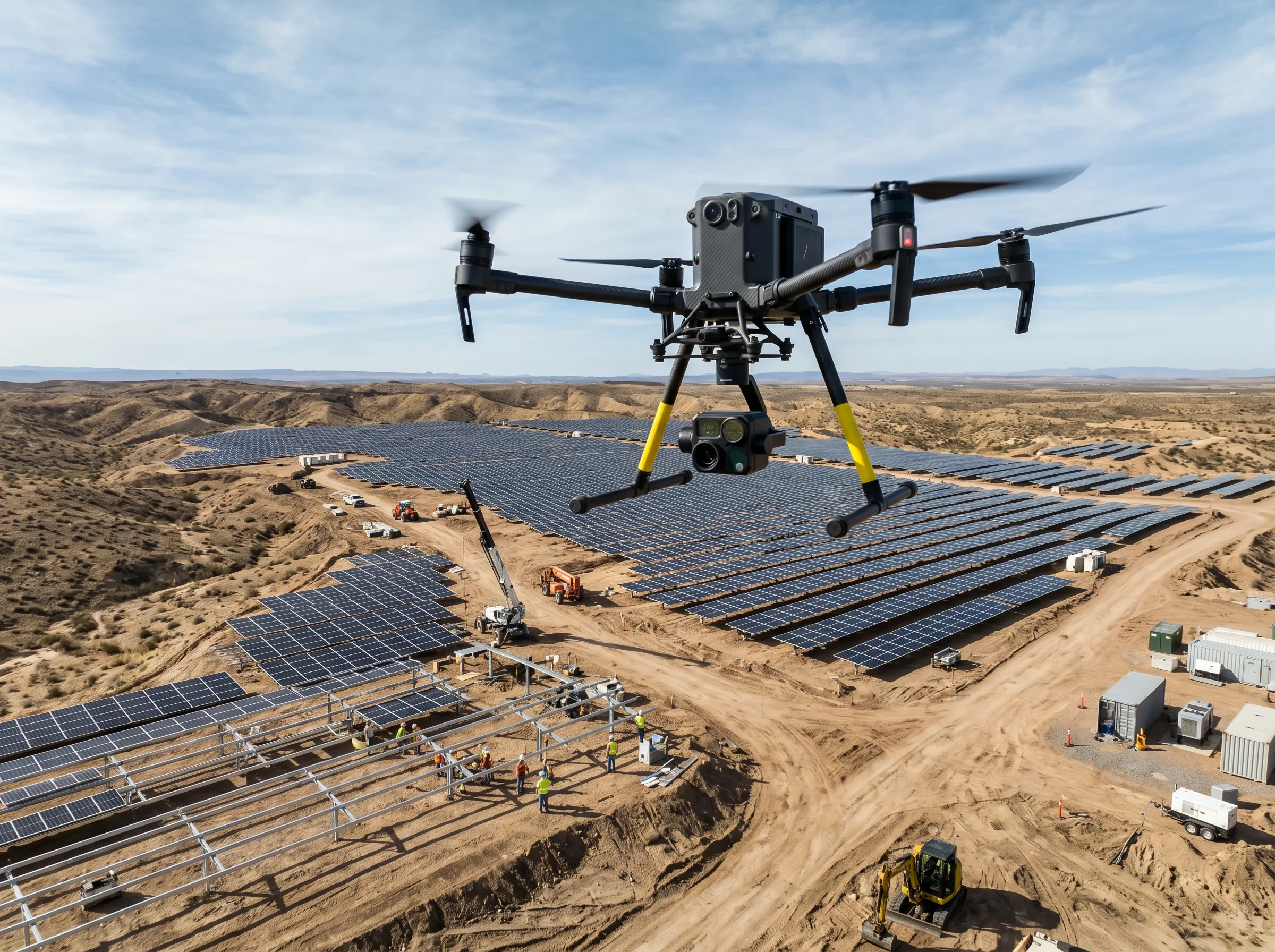
Drone Monitoring
Drone Analytics That Drive Enterprise Value
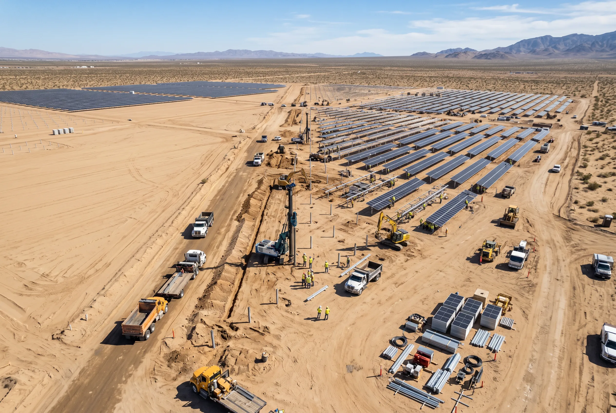
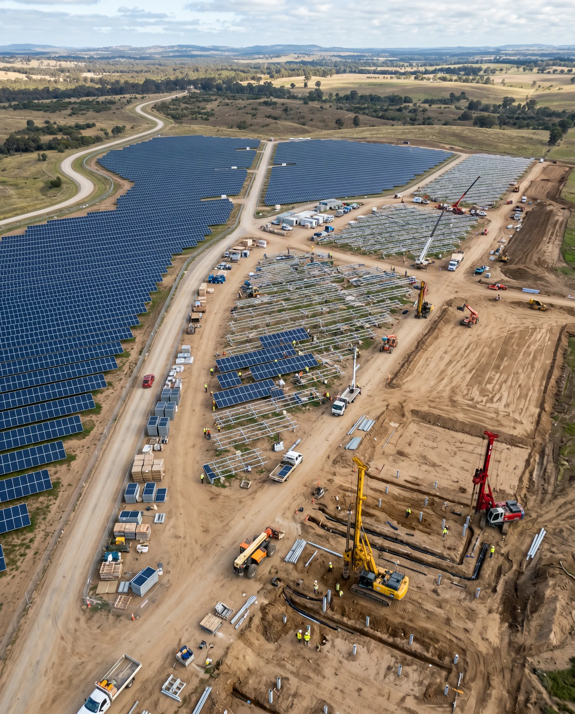
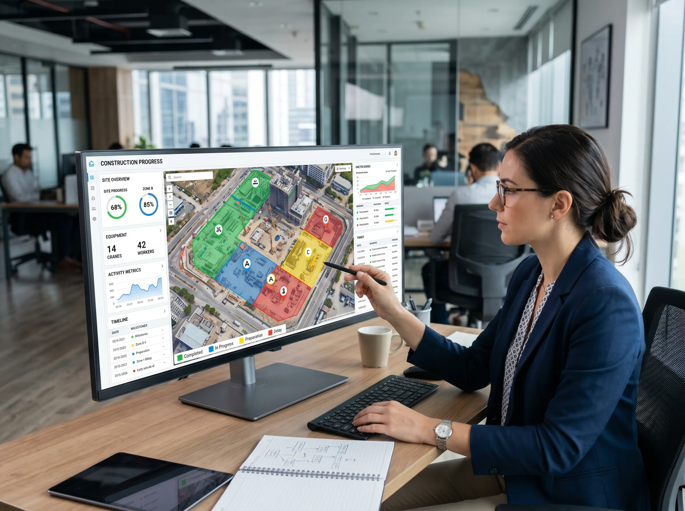
Construction Monitoring is where aerial data becomes operational. Instead of waiting on disconnected reports, teams can see actual progress from the first pile to the last module, compare movement across workfronts, and make faster decisions when execution starts to drift.
Real-Time Progress Visibility
See actual construction progress across civil, mechanical, and electrical workfronts. Track movement from first pile to last module with high-resolution aerial clarity.
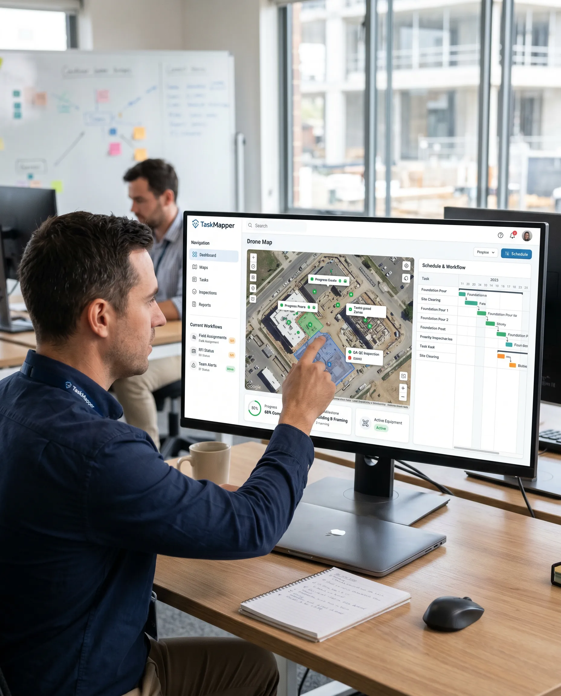
Connected to Project Operations
Drone insights flow into the same system used for schedules, QA/QC, and field workflows. No disconnected reports - everything lives in one geospatial record.
Schedule-linked Intelligence
Connect aerial progress to Primavera P6 or MS Project baselines. Generate real-time S-curves and give planners live visibility into what’s on track and what’s slipping.
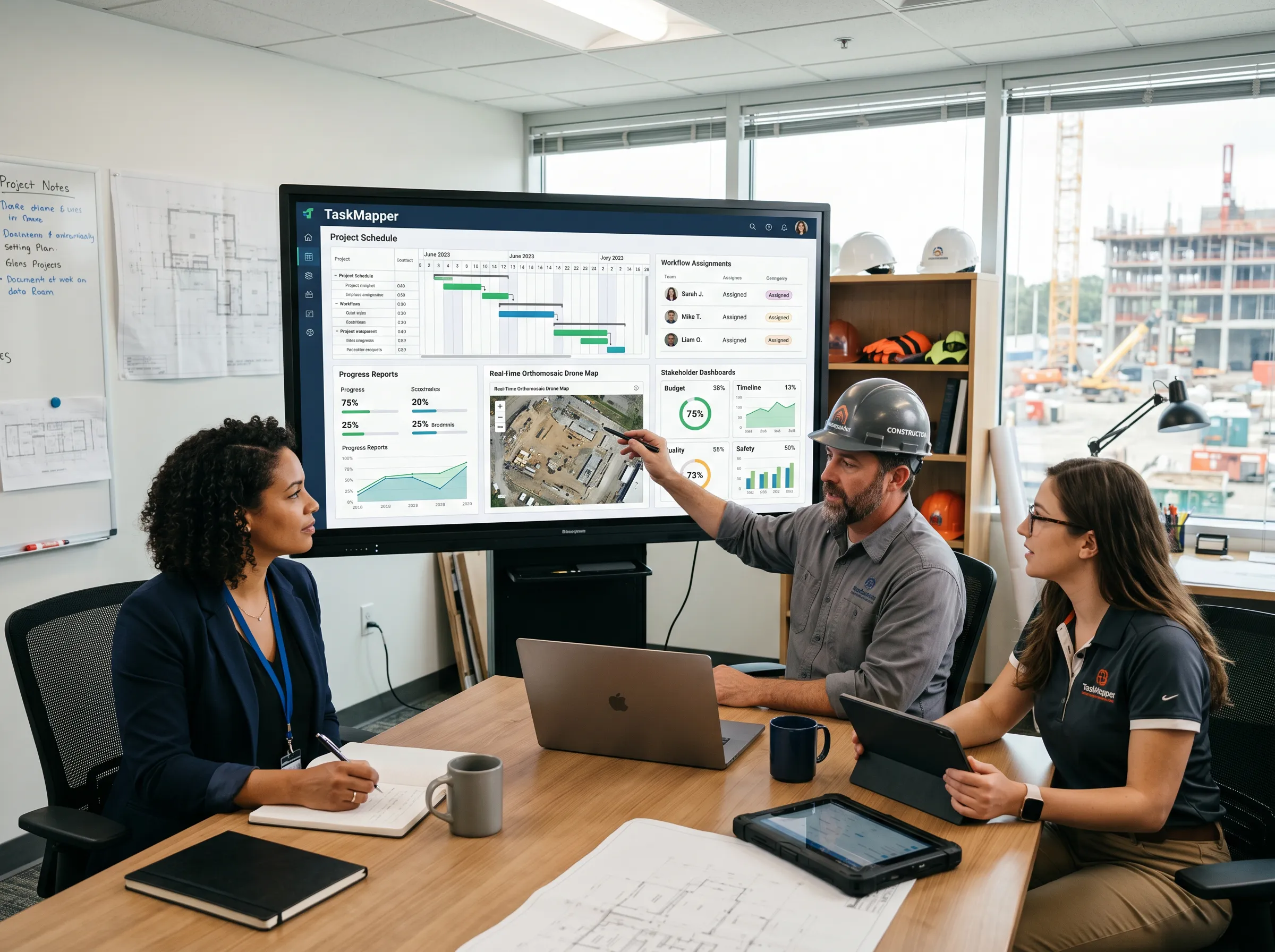
Schedule Intelligence
Connect Drone Progress to the Project Schedule
Drone monitoring becomes far more valuable when it is tied to the schedule. With TaskMapper, aerial progress can be connected to Primavera P6 or MS Project baselines through construction workflows, giving planners and project teams a live bridge between field reality and schedule logic. That means faster updates, schedule-linked S-curves, and a clearer view of what is on track, what is slipping, and where intervention is needed.
Track planned vs. actual movement in real time
Generate schedule-linked S-curves and dashboards
Link visible field progress to P6 or MS Project activities
Give project controls teams better site intelligence for recovery planning
Workflow
From Groundbreaking To Grid Operations
Four Steps from Aerial Capture to Operational Intelligence. SenseHawk turns drone imagery into structured progress data that teams can track, analyze, and act on - all connected to your project schedule and workflows.

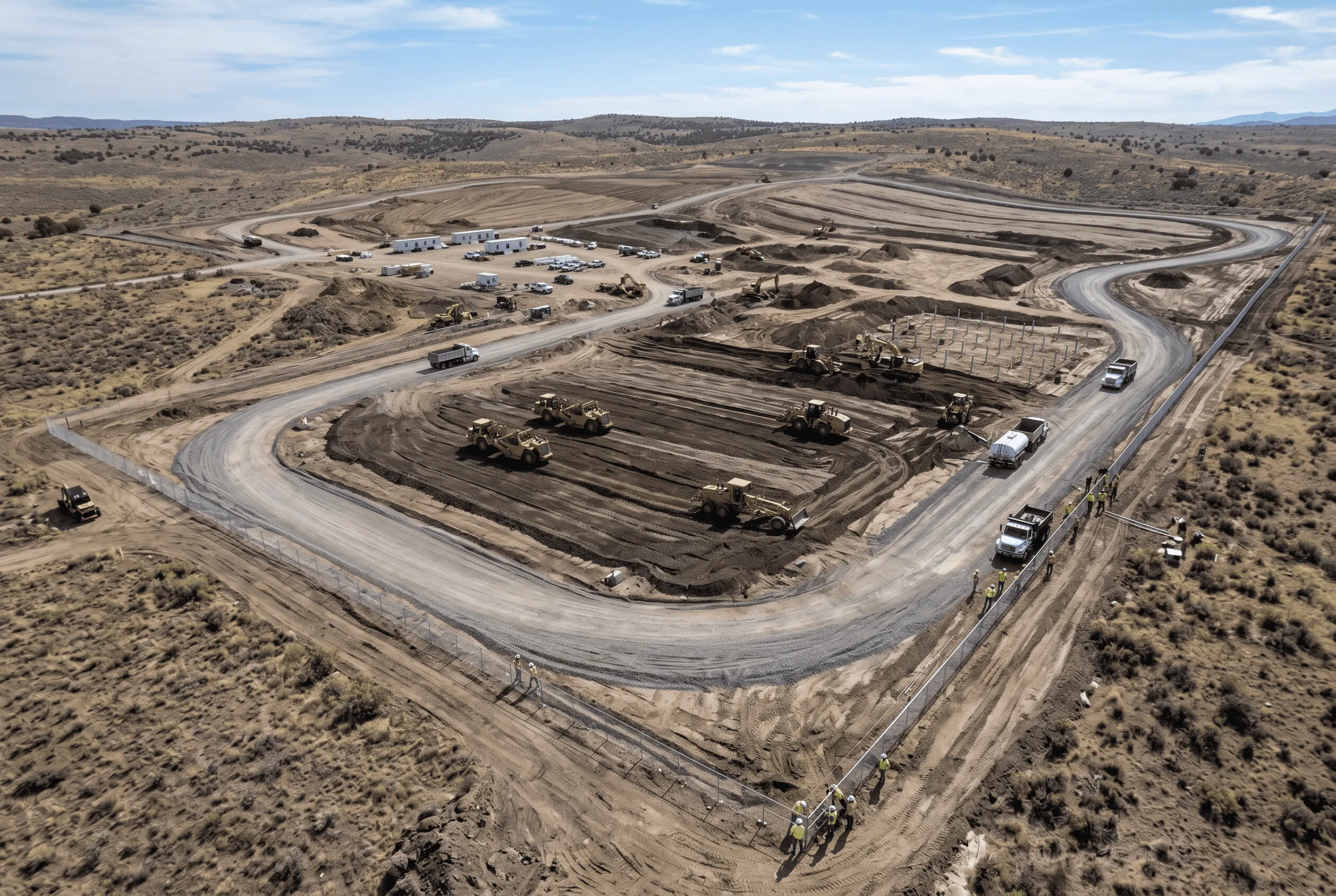
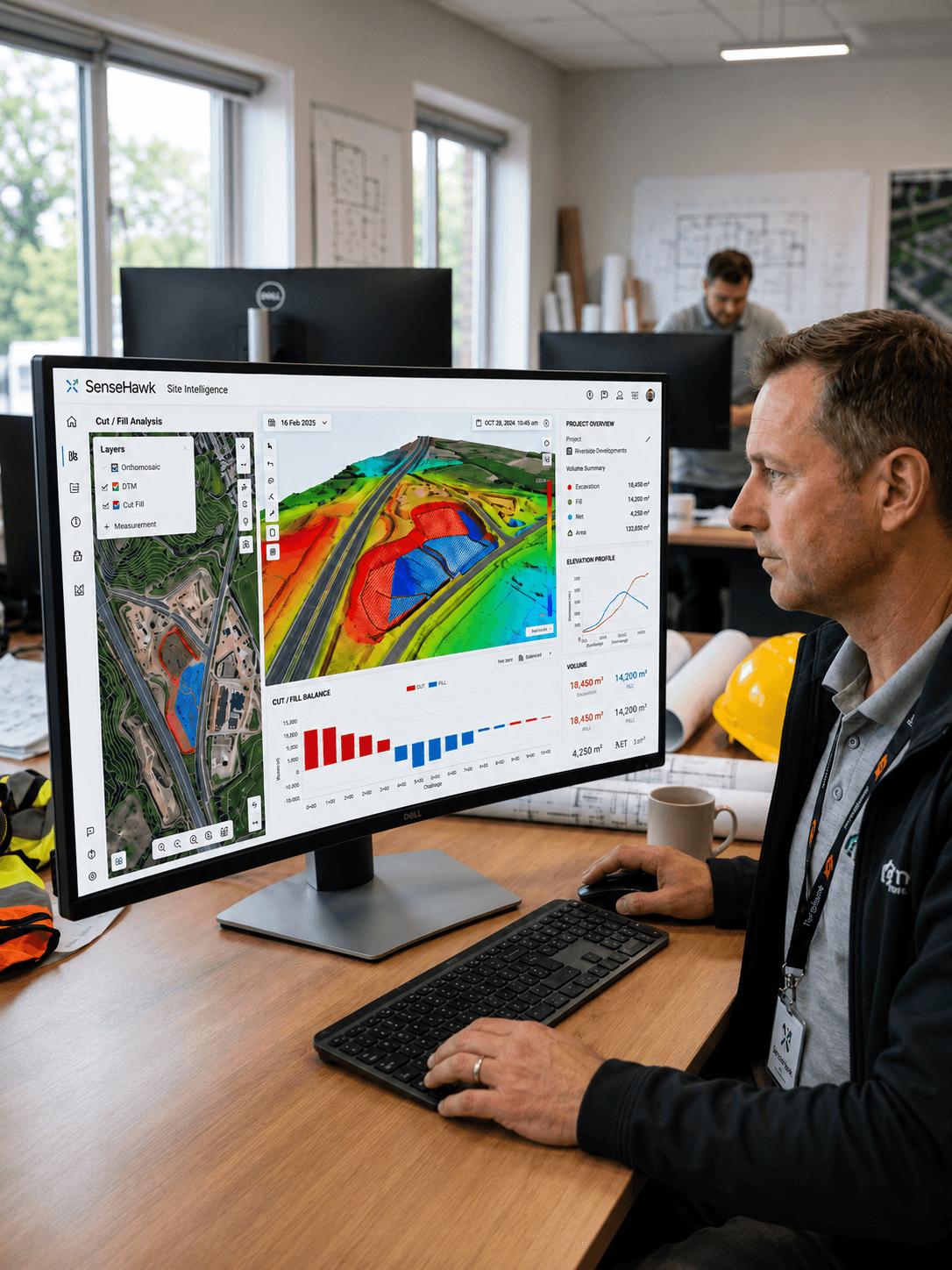
Terrain Monitoring
Monitor earthwork and terrain changes over time
Support cut/fill visibility during construction
Compare actual site conditions against design layouts
Improve planning for access, grading, and execution readiness
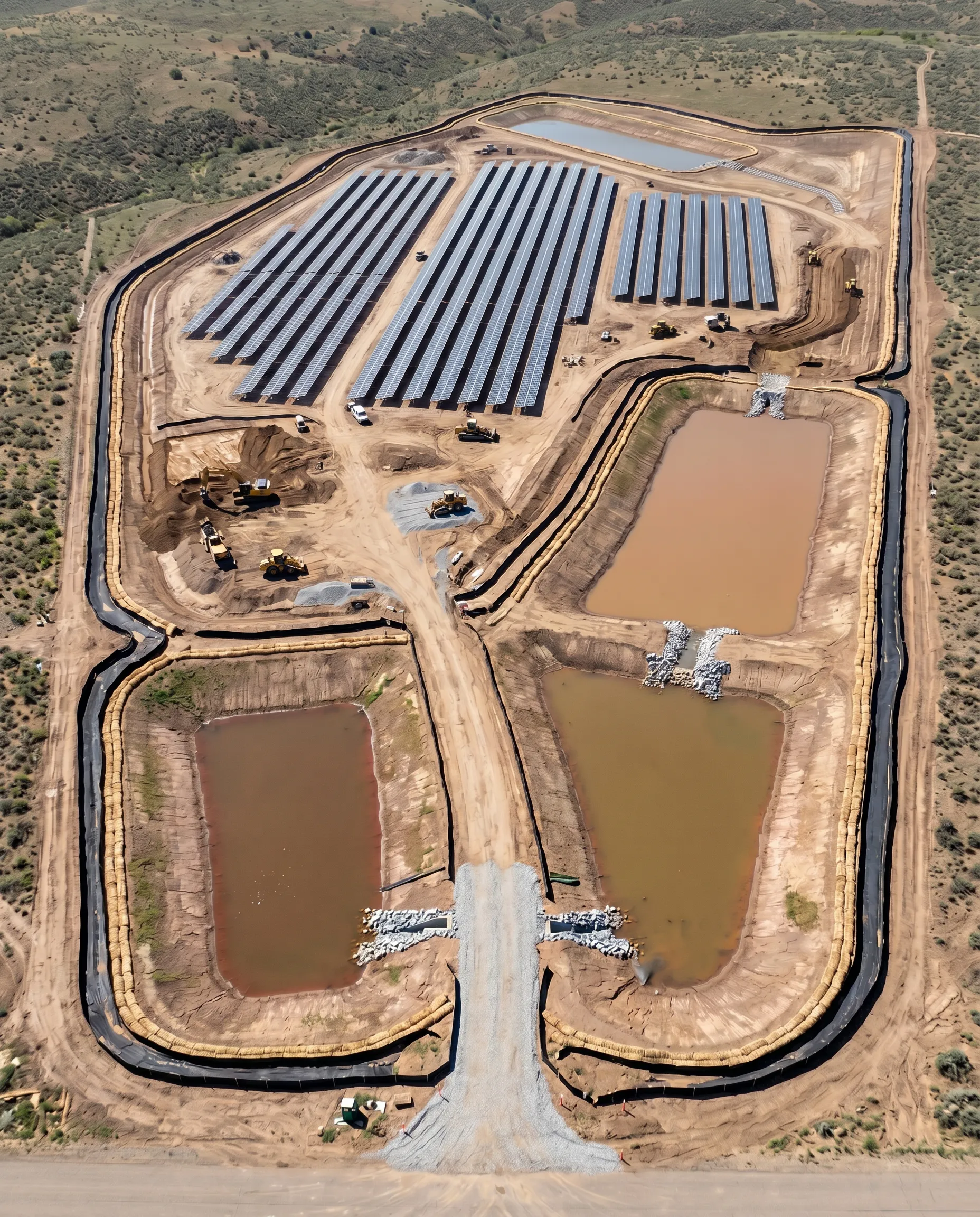
SWPPP Monitoring
Identify Erosion and Runoff-related Site Changes
Monitor Silt Fence Gaps and Breach Risks
Track Water Levels in Silt Ponds
Support Documentation and Field Follow-up Workflows
Connected Platform
Single Source of Truth
Drone insights flow directly into TaskMapper alongside schedules, quality workflows, and field updates. No disconnected reports - everything lives in one geospatial system of record.
From Observation to Action
Connect aerial progress to work orders, punch lists, schedule updates, and contractor workflows. Move seamlessly from seeing an issue to assigning follow-up - all in the same platform.
Stakeholder Alignment
Give field teams, planners, executives, and owners access to the same live aerial data. Everyone works from one connected view instead of managing separate drone deliverables.
Outcomes
Faster Visibility Into Actual Site Progress
Better Alignment Between Field Execution and the Schedule
Reduced Manual Reporting Effort
Earlier Detection of Deviations and Workfront Risk
Stronger Coordination Across Project Teams
Clearer Documentation for Stakeholders and Leadership

Built to Deliver Measurable Impact
Sites Digitized Across 20+ Countries
Frequently Asked Questions
Do I need to hire my own drone pilots?
How long does it take to process drone imagery?
What file formats do you support?