Land acquisition involves assessing land use, transmission access, and water rights to ensure project feasibility and compliance with zoning laws. It starts with identifying suitable land and gaining control over the power plant and transmission line areas through purchase or long-term leases. The key steps in the land acquisition process include:
Initial Assessment and Surveying
A land surveyor defines site boundaries to prevent disputes. Site maps are verified against cadastral or plat maps to confirm land location and ownership since multiple owners may be involved.
Negotiation and Acquisition
Negotiations include lease terms, purchase prices, and compensation details until final agreements (lease or sale deeds) are secured. This phase lays the groundwork for project development. Before any solar project can proceed, suitable land must be identified and secured. This involves navigating zoning laws, confirming transmission access, and ensuring compliance with all regulatory requirements.
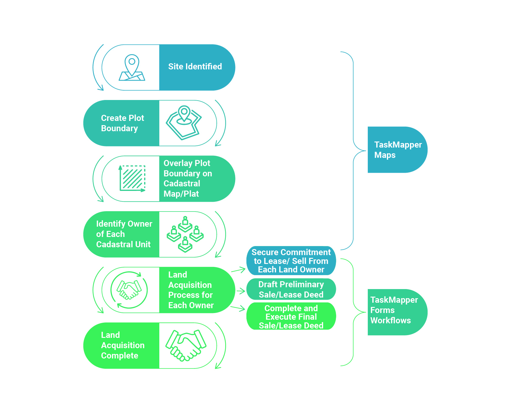
Typical steps in the land acquisition process for developing renewable energy infrastructure
How Does TaskMapper Help?
TaskMapper simplifies the land acquisition process with digital tools that enhance efficiency and transparency. The tools provided by TaskMapper include:
Mapping and Visualization
TaskMapper utilizes maps to delineate plot boundaries and overlay cadastral maps.
Ownership details and acquisition progress can be easily visualized and monitored.
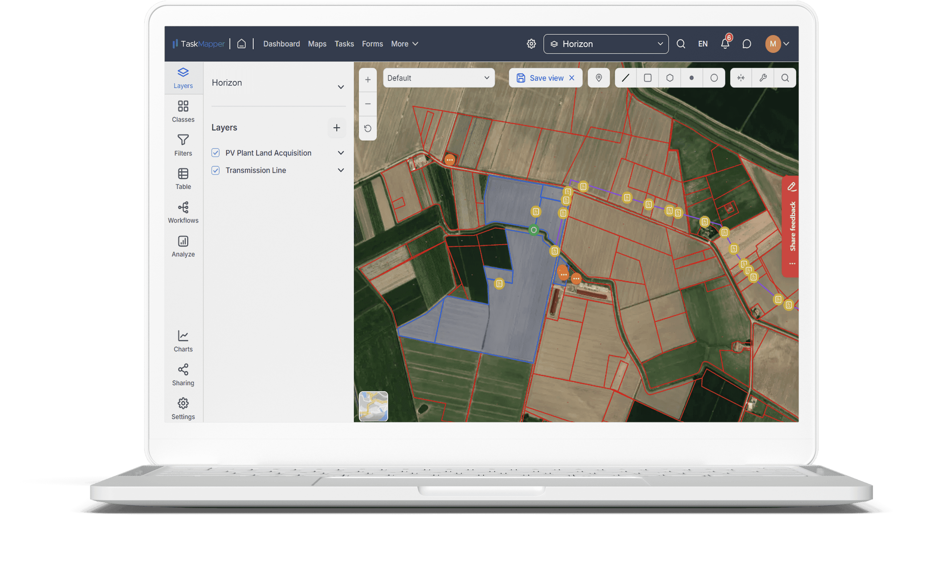
Visualize plot boundaries and details on Maps view of the site overlaid with cadastral/plat maps
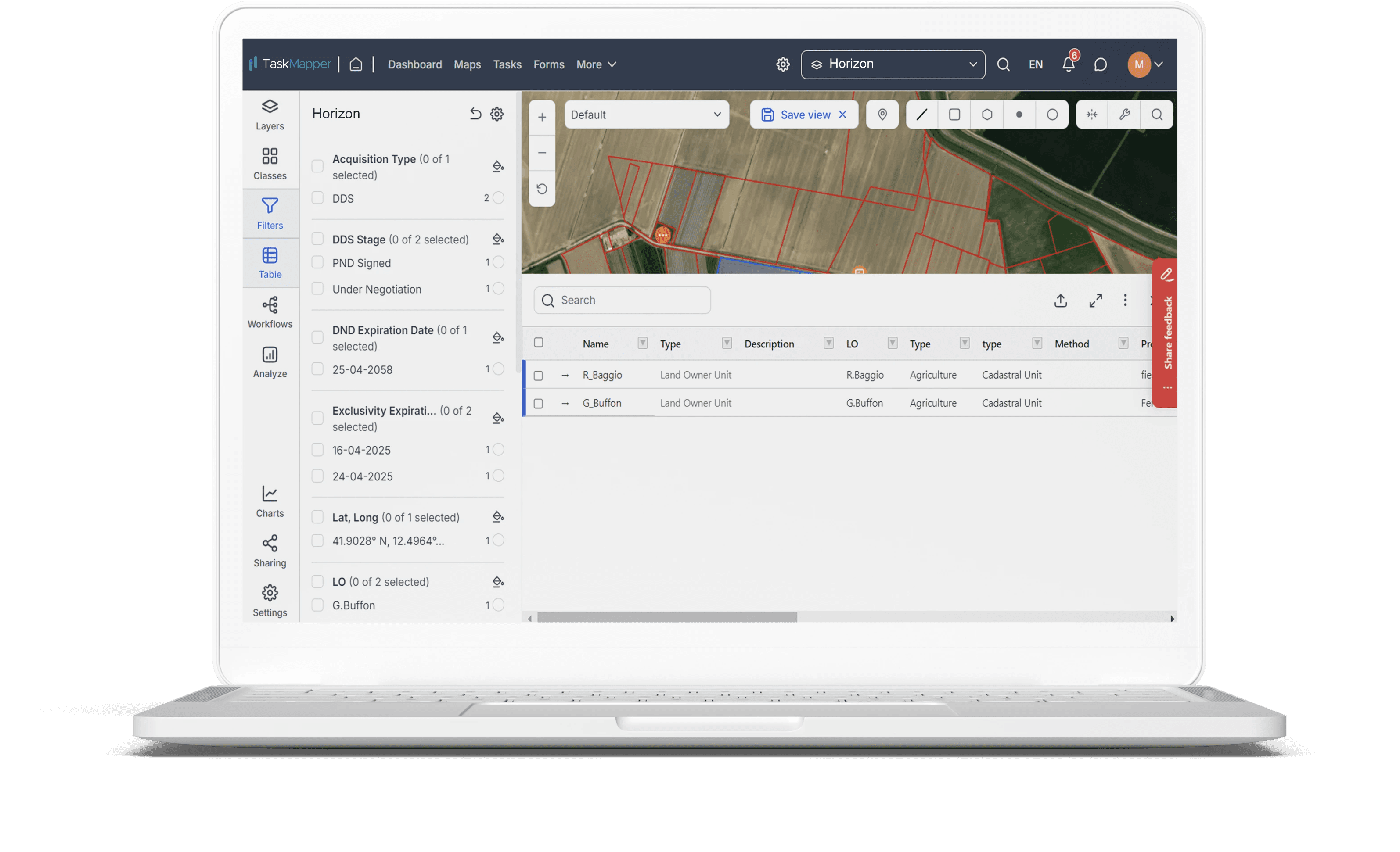
Filter map properties, access/ modify workflows, get information in Excel-like tables, easily share, and more.
Workflow Automation
Forms and automated workflows streamline processes for each landowner.
Progress tracking and status reports are generated automatically, ensuring timely updates.
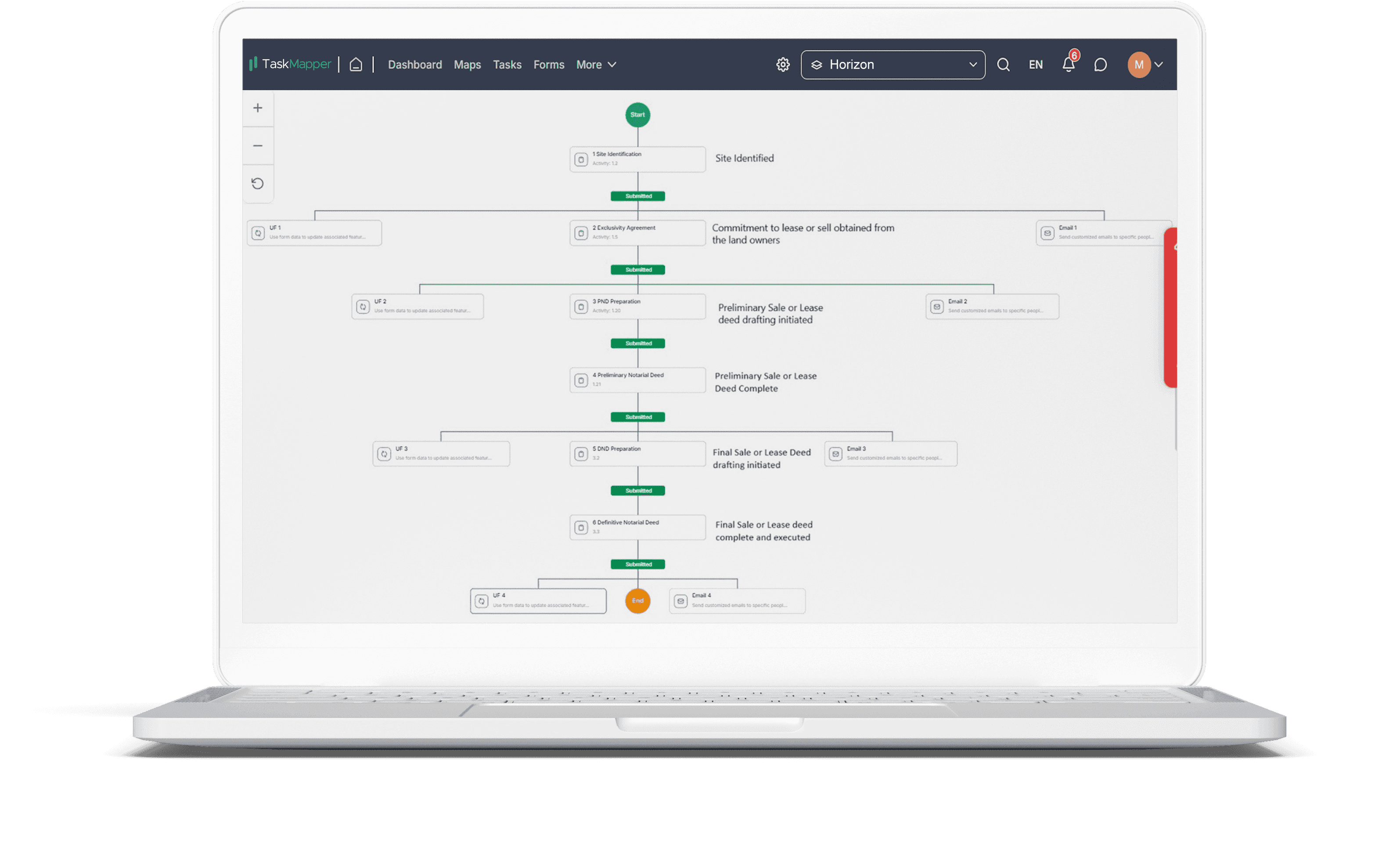
Create form-based workflow steps to automate land acquisition progress tracking and reporting
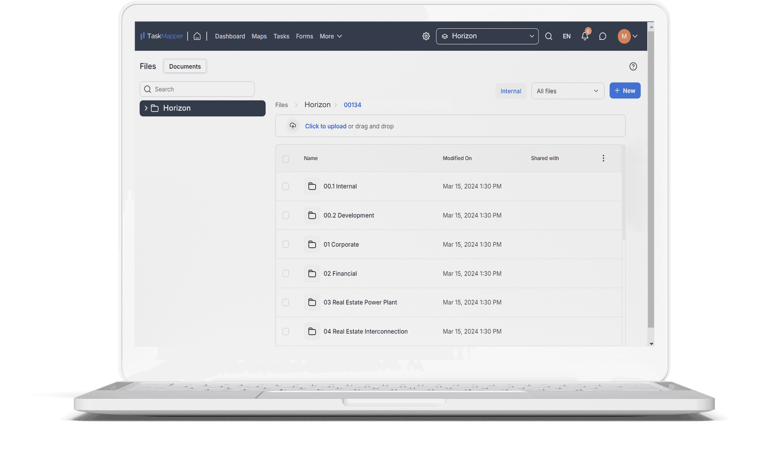
Document Management
All documents generated during the acquisition process are automatically organized and stored.
This ensures easy access and compliance with documentation requirements.
Create form-based workflow steps to automate land acquisition progress tracking and reporting
TaskMapper empowers solar project developers by simplifying the complexities of land acquisition. Its integrated tools for mapping, workflow automation, and document management enhance project efficiency and mitigate risks.
Up next
The next blog in this series explores the importance of securing right-of-way for transmission lines and looks at how TaskMapper continues to optimize solar project management.