Drone technology has transformed utility-scale solar project management by providing efficient, accurate, and cost-effective solutions for construction monitoring and O&M inspections. Unlike traditional manual inspections, drones equipped with high-resolution cameras and thermal sensors deliver precise, real-time data across large-scale solar installations.
Revolutionizing Construction Monitoring
Drones are an invaluable tool for modern construction management. They provide comprehensive coverage of large construction sites, capturing high-resolution images and geotagged data to track installations such as trenches, inverters, and access roads. This enables frequent monitoring without disrupting ongoing work, ensuring adherence to project timelines and specifications.
Their ability to deliver detailed data for progress reports helps project managers tackle issues promptly, allocate resources efficiently, and maintain safety by reducing the need for personnel to access hazardous areas.
Streamlining O&M Inspections
During operations, using drones equipped with thermal imaging sensors is a fast and efficient way to inspect expansive solar arrays to detect defects like hotspots and shading. Regular drone surveys identify anomalies early, enabling proactive maintenance that minimizes downtime and prevents expensive equipment failures.
Drone data integrates seamlessly into asset management systems, giving stakeholders a complete view of the asset’s condition and performance. This holistic approach supports long-term planning, operational reliability, and better investment decisions.
TaskMapper: Harness The Power Of Drone Analytics
TaskMapper by SenseHawk is a vertical enterprise SaaS solution designed for the solar industry. The unified platform provides complete lifecycle solutions for utility-scale solar installations. TaskMapper transforms drone-acquired data into actionable insights, improving workflows for both construction and O&M. It integrates advanced analytics, AI-driven insights, and real-time task management, to help reduce delays and costs while streamlining collaboration.
For Construction Monitoring
TaskMapper converts high-resolution drone imagery into layered maps, providing a detailed overview of site activities. Project managers can track progress over time, isolate specific components, and quantify installation advancements.
Comprehensive Visual Data: High-resolution maps with color-coded elements highlight activity progress for roads, trenches, piles, and trackers.
Layered Progress Tracking: Drone flights generate chronological map versions, helping managers monitor evolving project statuses like pile installations and inverter readiness.
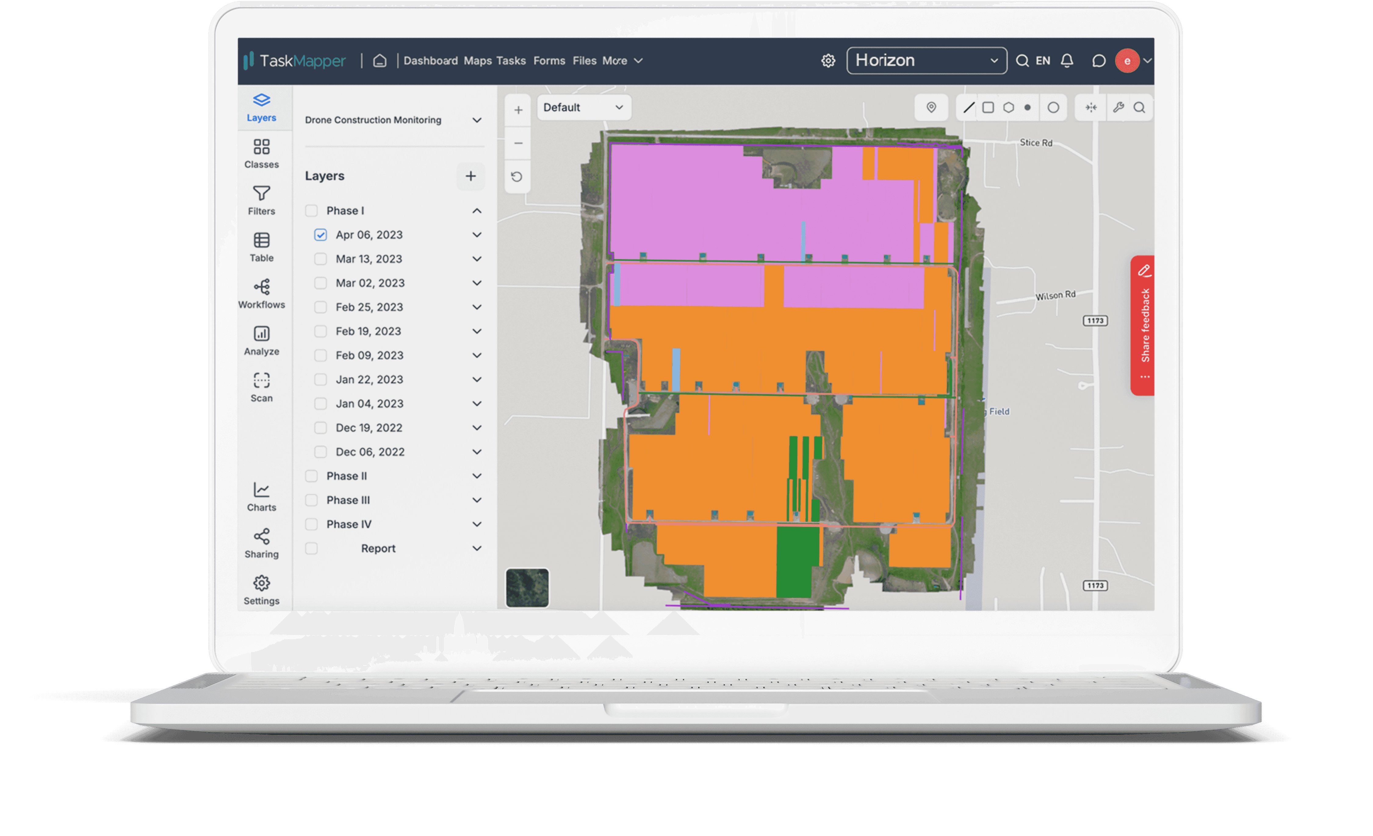
Layered component-level work progress data on Maps
Detailed Classifications: Construction elements such as trenches, fences, roads, and inverters are categorized with colors and icons for easy status checks.
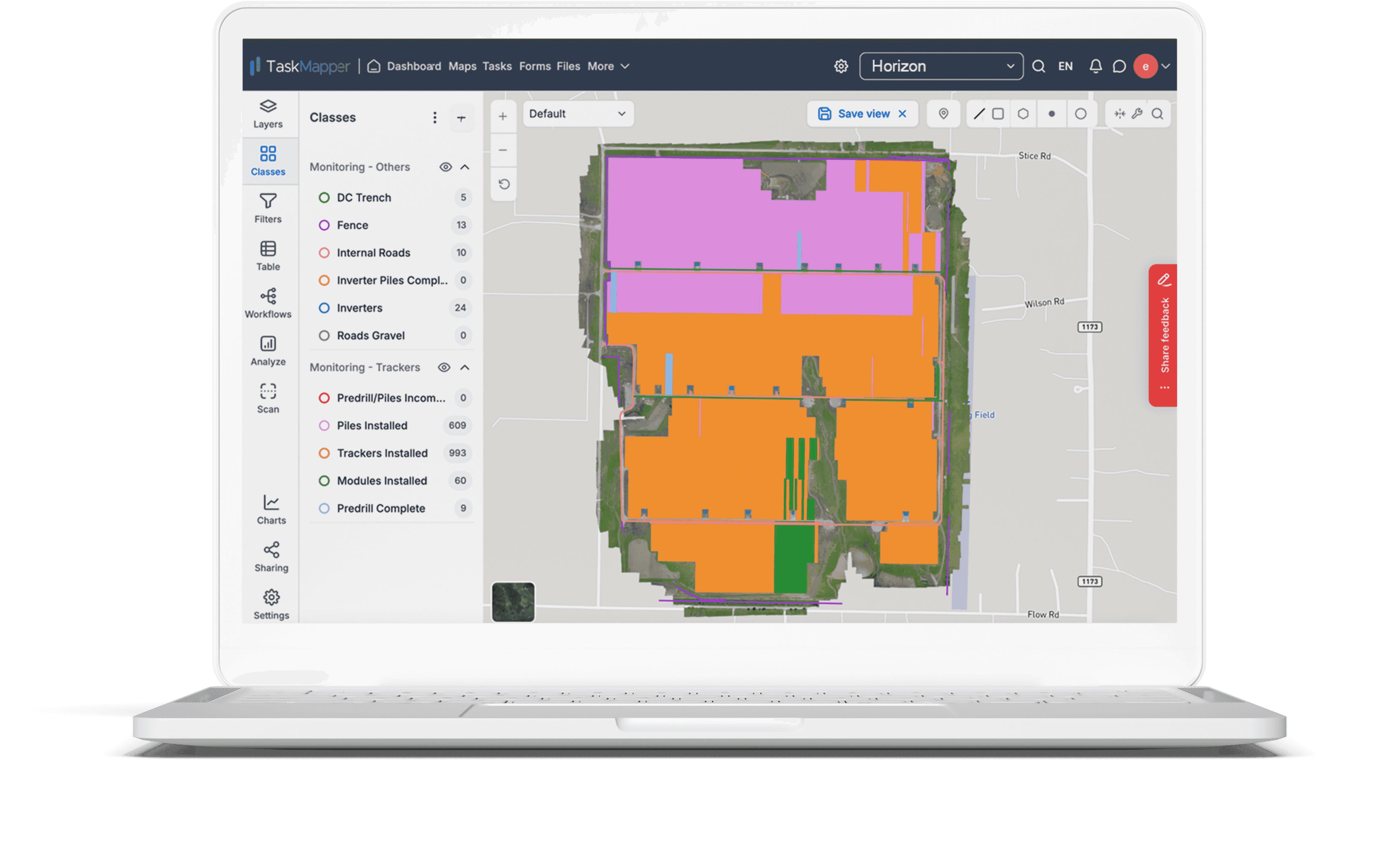
Installed component categories differentiated by color on digital site maps
Quantitative Data Integration: Maps paired with data tables provide insights into the installation progress of trackers, piles, and modules, ensuring accurate tracking.
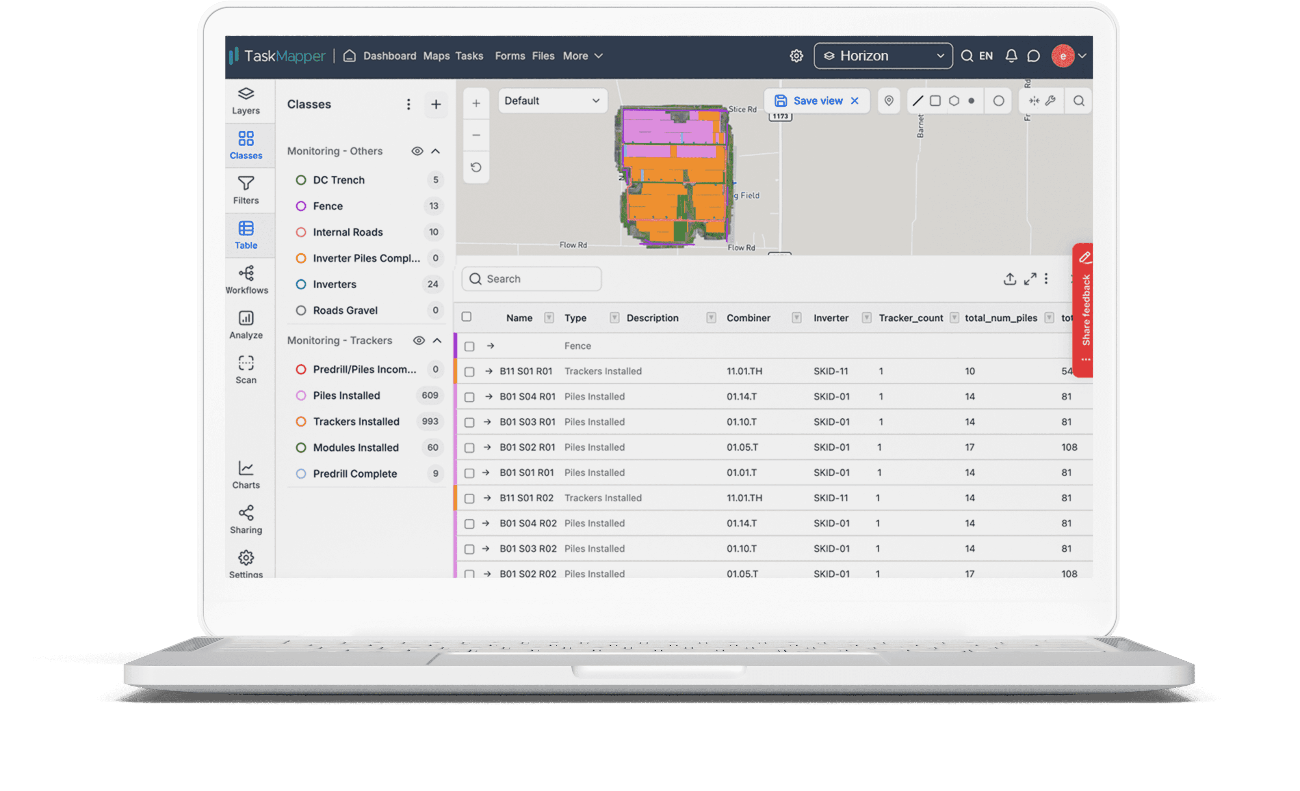
Map-based and tabular construction progress data
For Operational Insights
TaskMapper’s Therm module enhances O&M processes by integrating AI analytics, drone data, and fieldworker tools. The module identifies, prioritizes, and manages defects while providing actionable insights for efficient maintenance.
Maps: Drone-acquired imagery generates interactive thermal maps, enabling precise defect detection and analysis.
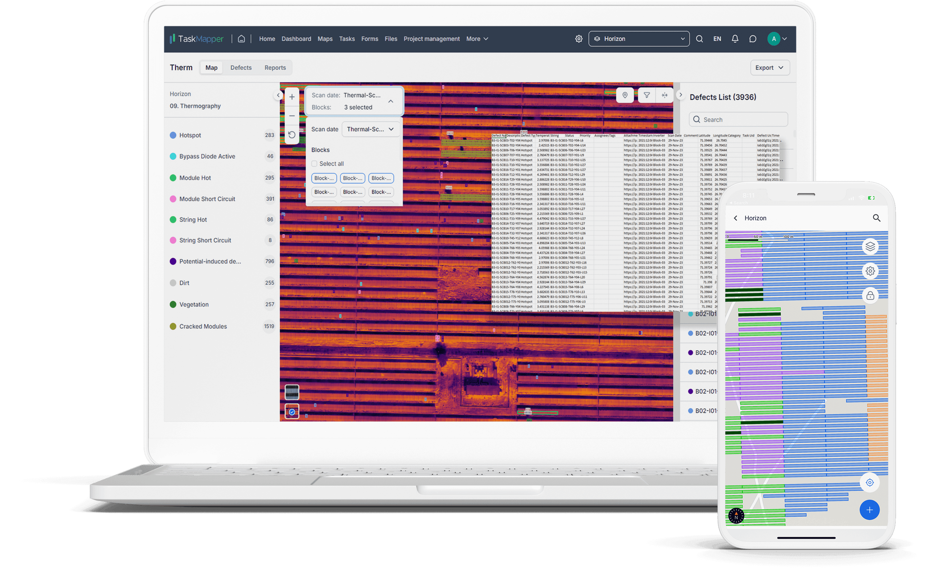
Interactive, data-enriched visual and thermal maps
AI Module: AI-powered classification prioritizes defects like hotspots or bypass diode failures, helping teams focus on critical issues.
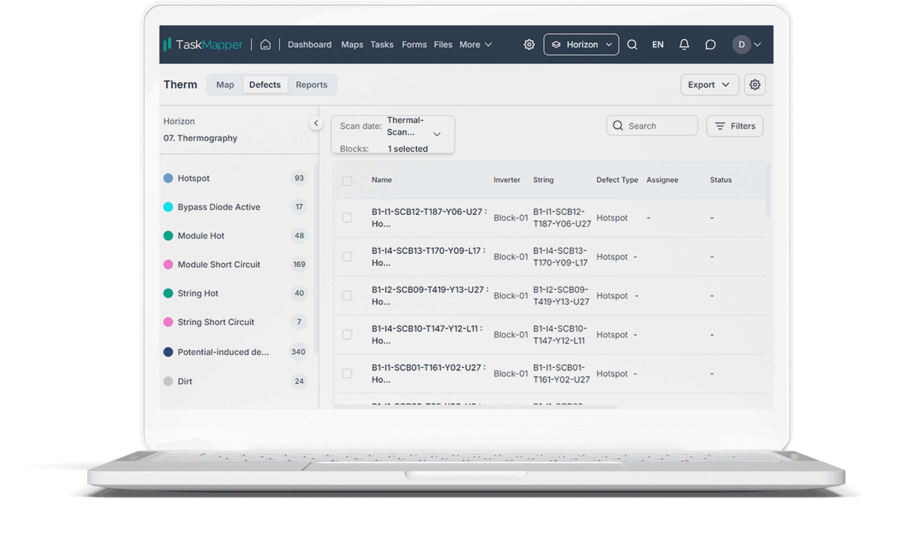
Comprehensive list of geolocated site defects with details
Tasks: Teams create tasks directly on maps with assignee details and due dates, streamlining field operations through a mobile app.
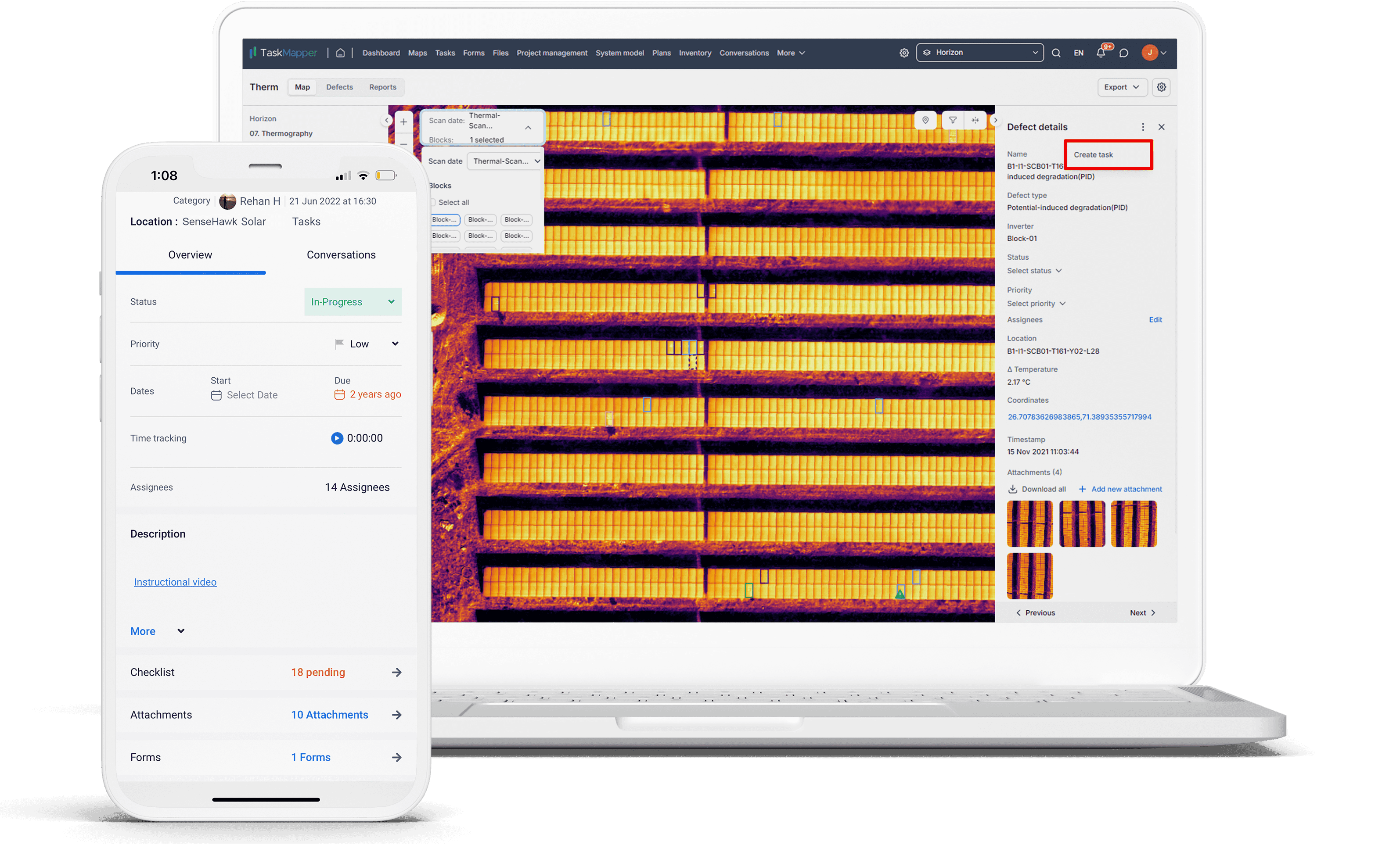
Create defect-related tasks and access on mobile
Reports: Automated reports in PDF or CSV format provide detailed defect analysis and enable seamless sharing.
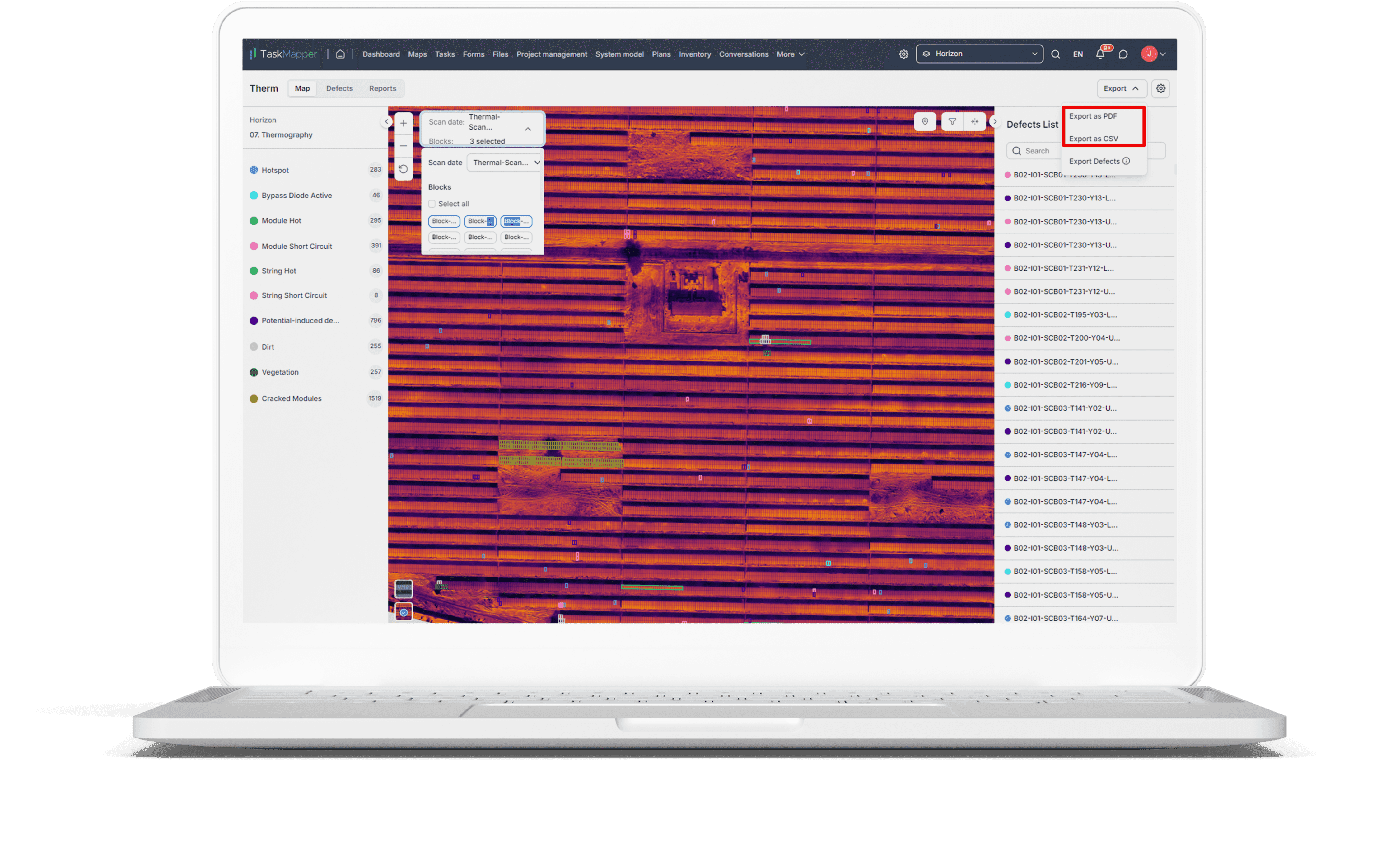
Easily filter, export, and share defect reports
Dashboards: Customizable dashboards track defects and provide visual analytics for informed decision-making and efficient project tracking.
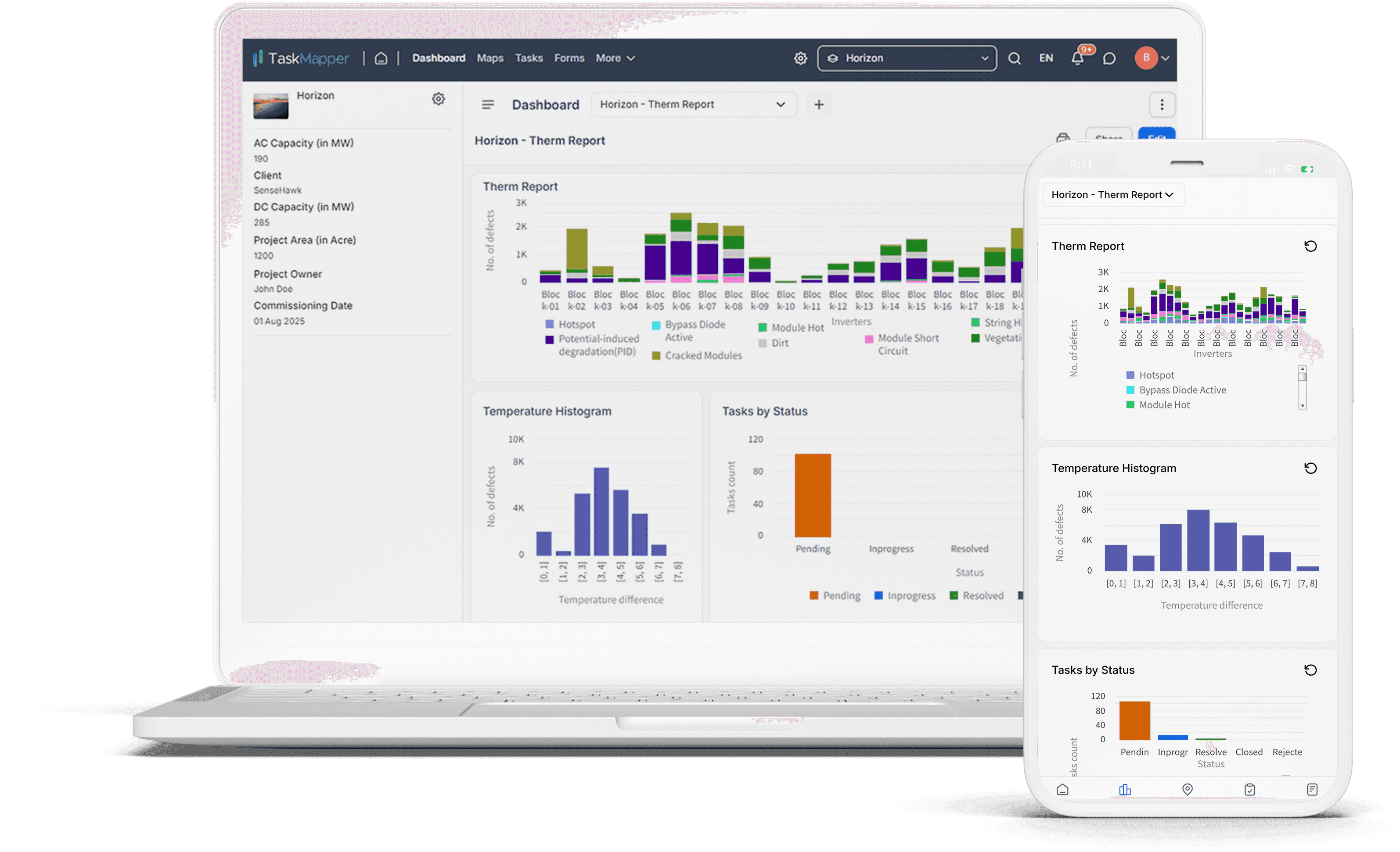
Track defects status on custom dashboards and export easily to share reports
With TaskMapper, solar developers and asset managers can fully harness the power of drone analytics to optimize construction and operations. By combining advanced mapping, AI-driven insights, and real-time task management, TaskMapper transforms solar project workflows into a more efficient, transparent, and cost-effective process.